


HILTON Voting District, Maricopa County, Arizona
About
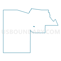
Outline

Summary
| Unique Area Identifier | 524545 |
| Name | HILTON Voting District |
| County | Maricopa County |
| State | Arizona |
| Area (square miles) | 2.35 |
| Land Area (square miles) | 2.34 |
| Water Area (square miles) | 0.00 |
| % of Land Area | 99.91 |
| % of Water Area | 0.09 |
| Latitude of the Internal Point | 33.42501330 |
| Longtitude of the Internal Point | -112.04942230 |
Maps


Graphs
Select a template below for downloading or customizing gragh for HILTON Voting District, Maricopa County, Arizona


Neighbors
Neighoring Voting District (by Name) Neighboring Voting District on the Map
- JULIAN Voting District, Maricopa County, AZ
- LOWELL Voting District, Maricopa County, AZ
- MONROE Voting District, Maricopa County, AZ
- PALMDALE Voting District, Maricopa County, AZ
- PARKVIEW Voting District, Maricopa County, AZ
- RIO VISTA Voting District, Maricopa County, AZ
- SKY HARBOR Voting District, Maricopa County, AZ
- SOUTH MTN HIGH Voting District, Maricopa County, AZ
- SUNLAND Voting District, Maricopa County, AZ
Top 10 Neighboring County Subdivision (by Population) Neighboring County Subdivision on the Map
Top 10 Neighboring Place (by Population) Neighboring Place on the Map
Top 10 Neighboring Elementary School District (by Population) Neighboring Elementary School District on the Map
- Roosevelt Elementary District, AZ (101,878)
- Phoenix Elementary District, AZ (55,104)
- Wilson Elementary District, AZ (3,852)
Top 10 Neighboring Secondary School District (by Population) Neighboring Secondary School District on the Map
Top 10 Neighboring State Legislative District Lower Chamber (by Population) Neighboring State Legislative District Lower Chamber on the Map
Top 10 Neighboring State Legislative District Upper Chamber (by Population) Neighboring State Legislative District Upper Chamber on the Map
Top 10 Neighboring 111th Congressional District (by Population) Neighboring 111th Congressional District on the Map
Top 10 Neighboring Census Tract (by Population) Neighboring Census Tract on the Map
- Census Tract 1149, Maricopa County, AZ (2,663)
- Census Tract 1152, Maricopa County, AZ (2,623)
- Census Tract 1153, Maricopa County, AZ (2,323)
- Census Tract 1154, Maricopa County, AZ (2,232)
- Census Tract 1172, Maricopa County, AZ (1,353)
- Census Tract 1138.02, Maricopa County, AZ (17)